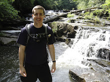
 Fall 2007 - Virgin Falls - 9 Miles (4.5 In/Out)
Of all the places that I've backpacked in Tennessee, this is my favorite. The hike can be difficult at times but it is well worth it. The water supplying the falls comes out of a cave at the top of a hill, plunges 110 feet and disappears into a cave at the base. Virgin Falls is located 20 miles southwest of Crossville.
Things to know: There are no rangers on site and no one patrols it regularly. This was originally a Bowater Pocket Wilderness. The state of Tennessee owns it now but it hasn't taken on official "park" status yet. There are no permits needed for staying overnight. There are some caves on the grounds. When things are drier you can explore some of the caves for short distances. If you do, be sure to bring multiple sources of light and travel in groups.
I won't go into great detail about this trail because it was covered very well in Hiking Tennessee by Kelley Roark, a book that I highly recommend if you're looking for backpacking trips in Tennessee broken down by region. A map is located in the book as well as the information board located at the trail head.
Parking is at (UTM, WGS 84) 16 S 655111 3969136.
Big Laurel Falls and a campsite is located at 16 S 652679 3967918.
There is a scenic overlook at 16 S 652937 3968416.
The main falls are located at 16 S 650822 3967326.
Directions can be found through the Tennessee website here.
Partial GPS tracks (2/3 of the trail) and all the waypoints above can be found at WikiLoc.


No comments:
Post a Comment